ITINERARY FOLLOWING THE TRANSHUMANCE
Among ancient pastures on the Mottarone
ITINERARY FOLLOWING THE TRANSHUMANCE
Between Lake Orta and Lake Maggiore, there is a place where beauty and tradition seem to be immune to modern times. We are talking about the mountain known as the Mottarone. Since the 19th century, generations of Milanese slowing trekked up to its peak, some did it on foot others took the little railway that connected Stresa with the Alpino, a charming little holiday location in past times. Today we explore these places on our trusty bikes with an itinerary astonishing for the variety of biotypes we will go through, natural beauties and the remains of an ancient world which we still find exciting.
WE DEPART FROM THE ROMANESQUE CHURCH
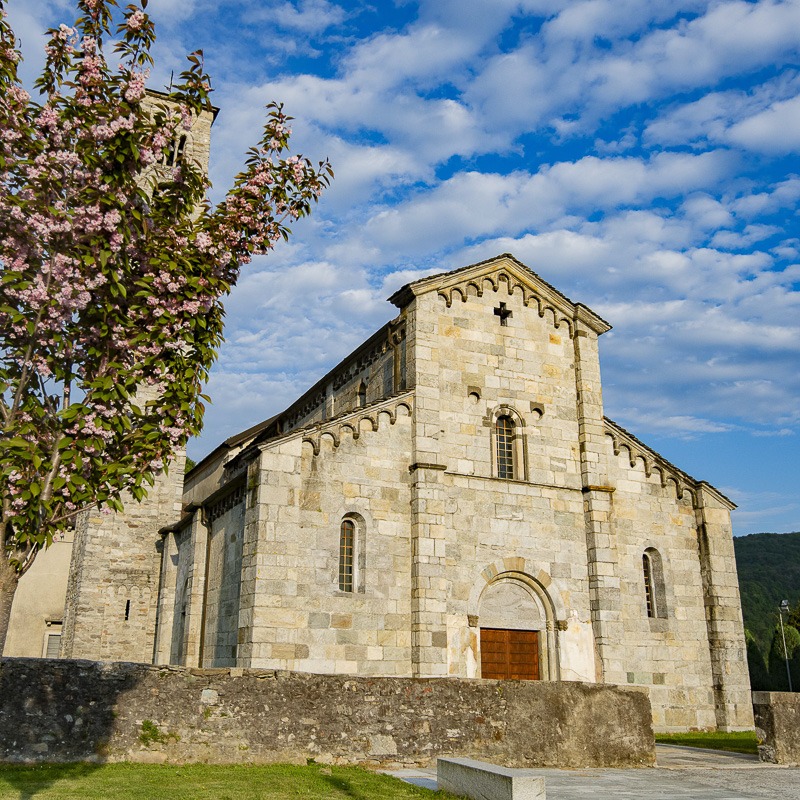
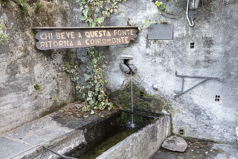
We leave from Armeno. In the remarkable Romanesque church square, dedicated to the Assumption (going back to the 1200s), we take off from the large free carpark and cycle towards the village, taking the narrow roads through the little village centre, between houses and little shops. After the village thins out, we go left on to a panoramic road which rises and winds through mountain streams, pastures and woods as far as the mountain village of Coiro Monte. This charming little village is still inhabited, in particular by a small community of Hindu inspiration (Mirapuri), but it is mostly a holiday place today, as indeed it was in the past, obvious from the impressive old patrician country residences that enhance it. We fill our canteens at the spring where, according to local legend, it is lucky to drink.
HARES AND MEADOWS
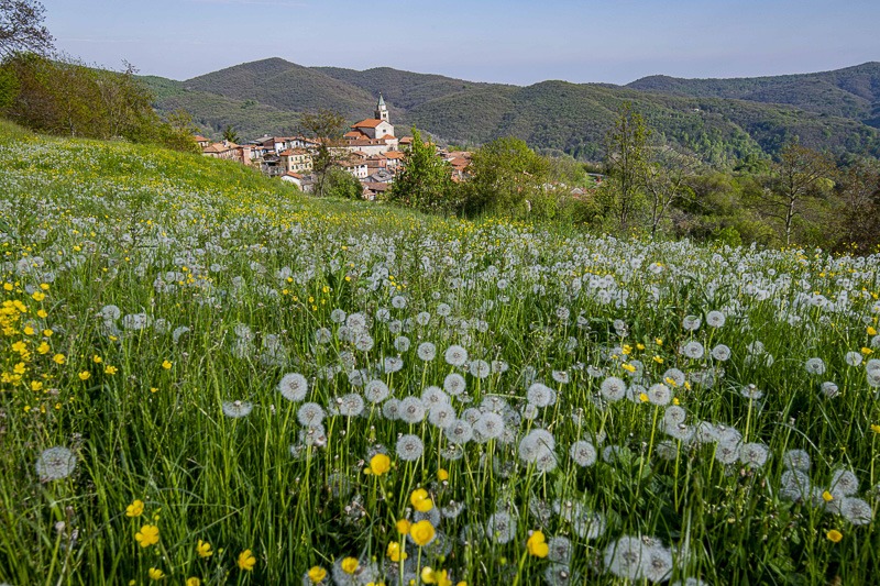
From here, we take the Via Monte Rosa, which goes round the high land of village while affording a very good view of it. When we get to a local cheesemaking facility with great local products, we turn right and leave the tarmac road and take path number S1 which rises steeply for 1 km through meadows which often see the arrival of hare and roe deer at dusk. After a series of bends, also steep, going around Monte Falò, also known as the 3 Montagnette, or 3 Little Mountains, we reach the Alpe La Cucca, where the path evens out. From here we go into the beech and chestnut woods while little streams bubble refreshingly and resound through the silence of this rural place.
VIEW OF MOTTARONE
After 2 km of broader trail, still on a slight incline, a view opens on the left over the Ondella valley with Mottarone in front of us. We go through a splendid forest of birch and enormous beech trees to get to the highest point of our route, the crossroad at the Alpe Nuovo. A stop here and then excellent signposting allows us to get our bearings very easily. From here we turn left continuing to follow path number S1, which narrows down a bit and takes us across a few alpine pastures that are still being used, such as the Alpe Farfossa, where we can fill our canteens again at a fountain.
If we go further on we will get to a new junction where we meet the Alpe Marigior, still well preserved and which whisks us back to the last century. We keep going left as we follow the S1 in the direction of Armeno and we see the Alpe Lovaga.
LIVING HISTORY
As we pedal on our way it is hard not to think of the history of these places which is still so very alive today. Before the early 20th century, Mottarone certainly looked quite different, and a different pace of life marked by breeding cycles, pastoralism and the alpine pastures.
This mountain historically was an important summer pasture place for herds of cows, sheep, goats and of course horses who enjoyed these open spaces until at least 1850 when the government of Sabaudia, worried that the animals might end up in the hands of the Austrians, decided to transfer them closer to Turin.
Around these mountain places, there was a mass of small, hard-working communities who distinguished themselves with their masterful preparation of butter and local cheeses.
STRAW ROOFS AND PROTECTIVE MADONNAS
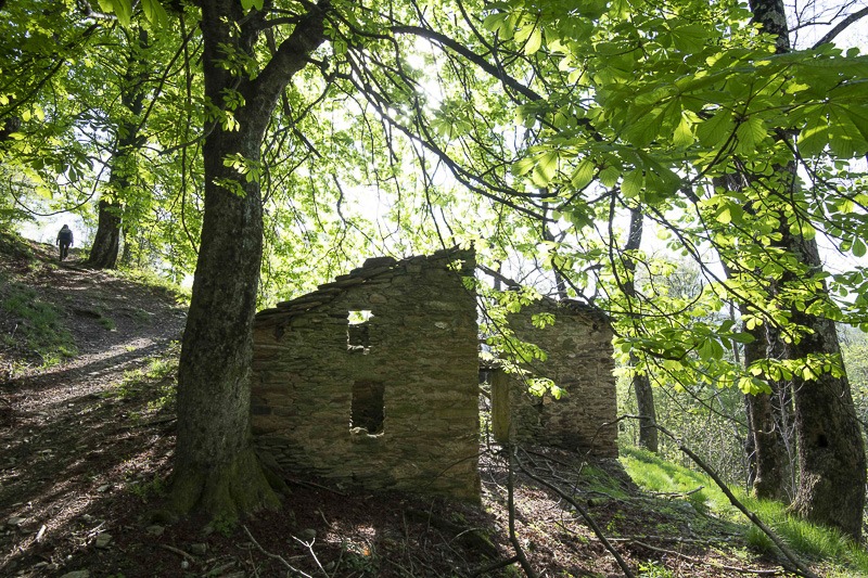
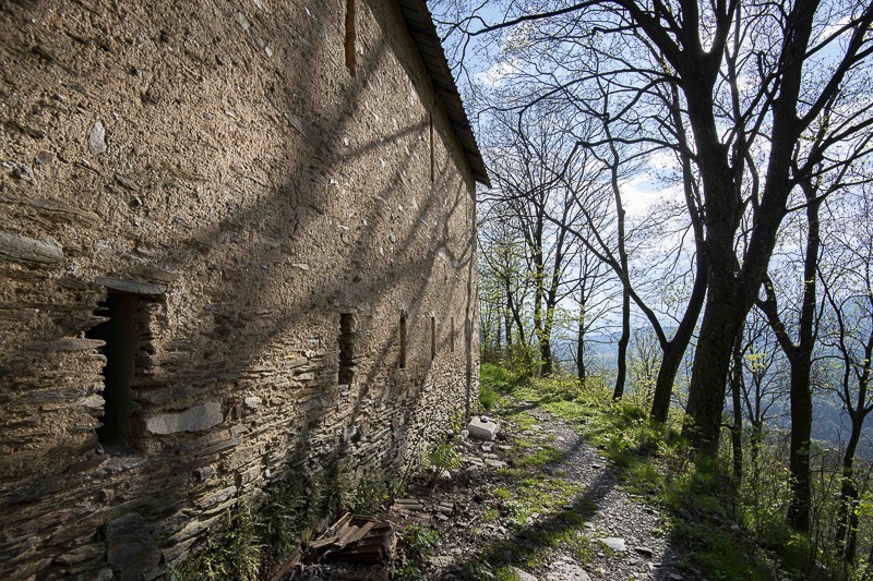
For a very long time the mountain was dotted with barns for the hay, with their characteristic straw roofs the remains of which are still visible. We pick up the path again and cycle down to the bottom of the valley, crossing another 2 alpine pastures which are today abandoned.
The path descends steeply and the surface is not always so kind or easy to negotiate due to the layer of beech leaves and a few stray branches along the way. In a large pasture, we find a herd of resident cows who follow us for quite a stetch.
After about 20 minutes we reach the bottom of the valley at the Torrente Ondella stream. River prawns, salamanders and frogs are witness to the health of these waters and the land we are going across. Before we reach the end of our route, we see a group of renovated mountain huts showing us what life was like in past ages.
On the upper floor is the shepherds’ summer residence with beneath it the cows’ stable while in front is a little area where they made the butter and cheese. ITINERARY FOLLOWING THE TRANSHUMANCE.
THE TRANSHUMANCE GOES ON
There are still a few families who do the transhumance, bringing their animals from Armeno and Pezzasco up to the Alpe Verdetta, others spend the summer period there with just a few animals and make butter by hand, using the typical wooden butter churn. Our tour ends at Armeno.
We recommend a visit to this decidedly rural and agricultural village, while you are here. Excellent Toma cheese from Mottarone is produced, and in case you did not visit it at the beginning of the route, do go and see the Church of the Assunta.
ITINERARY FOLLOWING THE TRANSHUMANCE
TYPES OF ROAD
Singletrack – 5.28 km
Path: 5.30 km
Bike path: 0 km
Minor road: 1.29 km
Asphalt road: 4.55 km
SURFACES
Natural: 5.22 km
Unpaved: 5.36 km
Dirt road: 0 m
Paved area: 916 m
Asphalt: 493 km
PHOTO GALLERY
FOLLOW OUR HIGHLIGHTS
EXPLORE THE TERRITORY BY FOLLOWING OUR ADVICE
Armeno
Scopri di più
Armeno sorge sulle alture al di sopra del Lago d’Orta, è il comune più settentrionale della provincia di Novara, oltre che uno dei più estesi territorialmente.
Valle ondella
DEMO FOTO
Prende il nome dal fiume Ondella che la attraversa
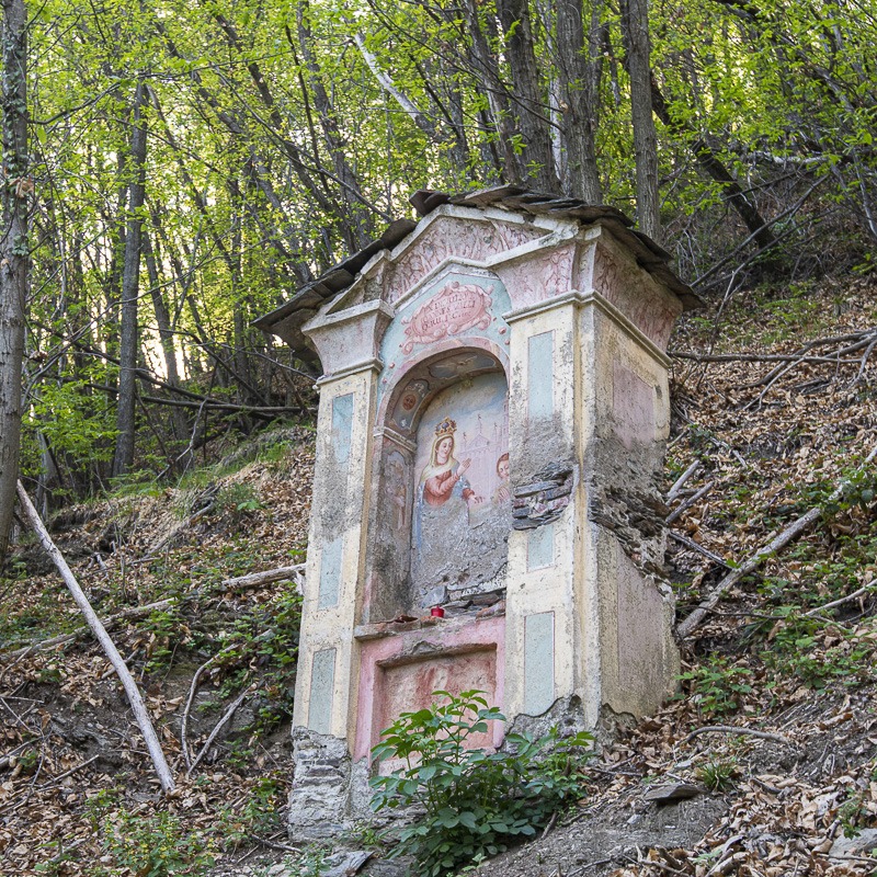
Cappelle votive
Scopri di più
Sono presenti numerose cappelle votive.
Coiro monte
Scopri di più
La frazione Coiromonte si trova ai piedi del monte Falò che domina la pianura novarese da un lato e le Alpi dall’altro. Il territorio è collinare-montuoso.
La fonte di Coiro
Scopri di più
REPERTI RURALI
Scopri di più
Mottarone
Scopri di più
Il Mottarone [1492] è una montagna granitica, situata in Piemonte, nel gruppo del Mergozzolo, nelle Alpi Pennine, suddiviso fra il Verbano-Cusio-Ossola e la Provincia di Novara.
Alpe Marigraz
Scopri di più
La faggeta
Scopri di più
Sono presenti alcune faggete, ad esempio sul Mottarone.
Alpeggi
Alpe
Scopri di più
Fauna e flora
Scopri di più
Abbondano i pascoli, le praterie e i boschi di faggi, betulle, larice e a alcune abetaie di abete rosso. Numerose anche le specie erbacee. Tra la fauna volpi, scoiattoli, lepri, caprioli, cervi e cinghiali. Tra i rettili la vipera aspis e la lucertola vivipara, nei fiumi le trote e i gamberi mentre tra i volatili il falco pecchiaiolo e il biancone.


